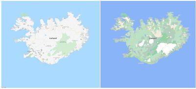
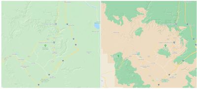
Google today announced a major update for Google Maps, which will see the feature gaining more detail and granularity to better highlight natural features and terrain.

Google is introducing a new color-mapping algorithmic technique that can take the high-definition satellite imagery used for Google Maps and turn it into what Google says is a "comprehensive, vibrant map of an area at a global scale."
The updated Google Maps app will provide a better look at an area's natural features, making it easier to see beaches, lakes, rivers, oceans, vegetation, and even mountaintops. Color-mapping works by using computer vision to identify natural features from satellite imagery, which are then analyzed and assigned a range of colors.

According to Google, the new Google Maps design is available in all 220 countries and territories that Google Maps supports, and in the near future, there will also be more detailed views of roads for pedestrians.

Google Maps will provide accurate road shapes and widths, along with the locations of sidewalks, crosswalks, and pedestrian islands. Detailed street maps will be coming to London, New York, and San Francisco in the coming months and will expand to other cities later.
Apple has also been working to improve the detail shown in the Apple Maps app, and has rolled out redesigned Apple 2.0 Maps across the United States. This year, those mapping updates are also set to come to Canada, Ireland, and the UK.
The updated maps provide more detailed roads, buildings, parks, marinas, beaches, airports, and more, to make it easier to navigate areas with these features.


