Apple Maps now supports transit in New Zealand, enabling users to navigate with public transportation in most populated areas of the country.
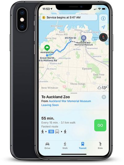
In the largest city of Auckland, directions are available for NZ Bus routes, AT Metro trains, or the SkyBus shuttle to the Auckland Airport. In the capital area of Wellington, directions are available for Metlink buses and trains.
Between select destinations in New Zealand, Apple Maps can now provide directions for InterCity buses and Great Journeys trains and ferries.
The feature can be accessed by selecting the Transport tab or button in Apple Maps on iPhone, iPad, Mac, or Apple Watch.
Apple Maps has supported transit since 2015, with an initial rollout in Baltimore, Berlin, Boston, Chicago, London, Los Angeles, Mexico City, New York, Philadelphia, San Francisco, Sydney, Toronto, and China. Since then, Apple has expanded the feature to many other regions around the world.
Google Maps has supported transit directions for several years now, but Apple Maps is steadily catching up with detailed routing information.
(Thanks, Ram!)

















Top Rated Comments