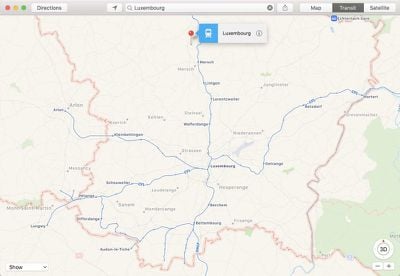
Apple recently updated its Maps app to expand the availability of transit directions to several new regions.
Transit data is now available in Luxembourg, a country that has an expansive transit system including buses, trains, and the Luxembourg City tram.

Apple also appears to have made transit data available in several new cities in Pennsylvania, Texas, Washington, and Oregon.
Transit directions were previously available in some of these locations in select cities such as Philadelphia, Houston, Dallas, Seattle, and Portland, but the transit information appears to have expanded to encompass much of these states.
In Canada, Apple has added support for the VIA Rail system that operates across much of the country, spanning more than 7,000 miles across eight provinces. Popular lines include the Canadian that runs between Toronto and Vancouver and the Ocean running from Montreal to Halifax.
There's also a Corridor service between Ontario and Quebec, and several adventure routes offering transportation to rural areas.
Transit directions were first added to Apple Maps in 2015 with the launch of iOS 9. Maps initially only offered transit information in a handful of cities, but over the course of the last few years, Apple has worked to expand the feature to additional areas.
Transit information is now live in dozens of cities and countries around the world, with a full list available on Apple's iOS Feature Availability website.
(Thanks, Ram!)


Top Rated Comments
I prefer GO due to the cheaper fares, but if you’re in a time crunch VIA is quicker, at least from my city to Toronto.
Although routes seldomly, if ever, change; it’s nice to just use Apple maps to see when the next train is leaving.