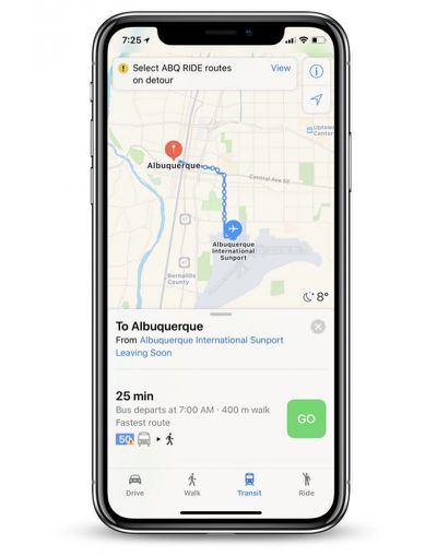
Apple is beginning to update Apple Maps with transit directions in Albuquerque, New Mexico, allowing residents of the city to navigate around it using various methods of public transportation.
To enable transit between two locations within Albuquerque, tap the "Transit" tab at the bottom of Apple Maps once you enter your route. This will surface a series of transit stops on the trip, along with relevant caution advisories, route detour information, fastest route options, and more.

One of the transit options available for Albuquerque residents is ABQ Ride, a local agency that operates within the city with a variety of bus routes for commuters. When applicable in certain cities, transit directions also support subways, trains, and ferries, and in 2016 Apple added support for Amtrack's full system of train routes across the United States and in select Canadian cities.
In 2015 Apple first launched transit in Apple Maps, limited to Baltimore, Berlin, Boston, Chicago, London, Los Angeles, Mexico City, New York, Philadelphia, San Francisco, Sydney, Toronto, and around 300 cities in China. In the three years since then, Apple has expanded the feature to dozens of additional cities around the world.
Apple Maps rival Google Maps updated yesterday with an expansion of its own transit features, adding options for New York, Hong Kong, Taipei, Paris, Los Angeles, Delhi, Moscow, Singapore, Madrid, Barcelona, Kiev, and Budapest, with "more on the way."
(Thanks, Ram!)


Top Rated Comments
I've been using Google Maps for quite some time now because of these directions missing from the stock Maps app. I look forward to trying out Apple's take on it