Apple Maps has been updated with comprehensive transit data for the Detroit, Michigan metropolitan area, and for the Canadian city of Windsor, Ontario directly across the Detroit River, enabling users in both cities and certain suburbs to navigate using public transportation such as buses and trains.
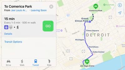
In the Metro Detroit area, Apple Maps routing supports DDOT and SMART buses, the Detroit People Mover, the Michigan Flyer, and Amtrak. Limited navigation extends to a number of Detroit suburbs in Oakland, Macomb, and Wayne Counties, including Ann Arbor, Dearborn, Pontiac, Sterling Heights, and Warren.
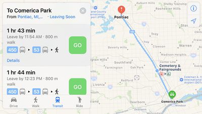
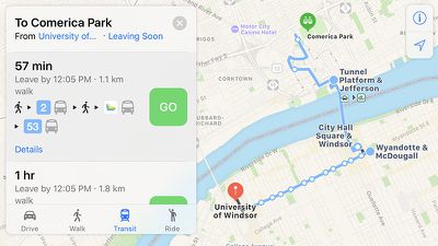
In the Windsor, Ontario area, Apple Maps routing supports Transit Windsor buses. Navigation extends to immediate suburbs in Essex County such as Tecumseh, Ontario. Tunnel Bus routing is also available for cross-border trips between Windsor and select locations in the Metro Detroit area.
Apple introduced Transit in Maps as part of iOS 9 in select cities around the world, including Baltimore, Berlin, Boston, Chicago, London, Los Angeles, Mexico City, New York, Philadelphia, San Francisco, Sydney, Toronto, and over 300 cities in China. The feature has its own tab in Apple Maps on iOS 10 for entering directions.
Transit continues to expand to several other cities, including Atlanta, Columbus, Dallas, Denver, Honolulu, Houston, Kansas City, Melbourne, Miami, Minneapolis–Saint Paul, Montréal, New Orleans, Pittsburgh, Portland, Prague, Rio de Janeiro, Sacramento, Salt Lake City, San Antonio, San Diego, Seattle, Vancouver, and Victoria.
(Thanks, Bernd and David!)









Top Rated Comments
The first time I used Apple Map (when it first came out in 2012) I asked Siri for directions to Dave & Busters and I was directed to a literal hole in the ground. Like, a brand new construction site on the outskirts of the city. I gave up on Apple Maps for a few years after that.