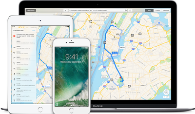
Apple will add grade crossings to Apple Maps after a safety recommendation from the National Transportation Safety Board (NTSB), reports The New York Times. The recommendation comes after a two year investigation into an accident that occurred after a driver got his truck stuck on railroad tracks while following directions from Google Maps.

Grade crossings are places where the road and railway lines are at the same level. The case the NTSB cites in its recommendation is that of Jose Alejandro Sanchez-Ramirez, who misinterpreted directions from Google Maps and wound up on a poorly marked grade crossing. His truck, which was hauling a trailer, got stuck on the tracks. While Sanchez-Ramirez was able to abandon his vehicle, a train struck it and resulted in the death of an engineer and injuries to 32 others. There were more than 200 fatalities at grade crossings last year in the U.S.
Today, the NTSB issued a safety recommendation that Google and other map providers, like Apple, should add exact locations of more than 200,000 grade crossings to their mapping data. The Federal Railroad Administration has been lobbying Apple and other tech companies to add the data for the past 18 months.
Apple and several other companies, like Google, Microsoft and MapQuest, have agreed to add the data but have not disclosed when they will integrate grade crossings into its mapping apps. The NTSB's recommendations are not binding, but they can used to pressure companies and lobby Congress to take action.
Investigators believe lack of warning in Google Maps was one of several factors that contributed to the accident, including driver fatigue and a lack of more distinctive signage at the grade crossing. There have been five accidents at the crossing since 2008.


Top Rated Comments
I fired up Apple maps and it got me round the roadworks and home, so will give it another chance now :)
Side note: What we need is for Siri to tell me what lane to be in. If I go out of the city I switch to google maps. Especially in Jersey...
My point? Besides not seeing the NTSB's logic here, and RM's initial post - as I still follow the industry pretty closely, is that Mr. Sanchez-Ramirez had been working for more than 24 hours straight before the accident. He was delayed during his trip for several (about 4) hours, and he was also involved in an accident on that same trip - delaying him further. He was given written instructions, in his native language, but chose to use Google Maps - which has plenty of disclaimers about accuracy. He also admitted to suffering from fatigue and not being familiar with the area in which the accident took place. Then, he drove more than 75 feet on the rails in parallel to the rail line, after turning in the direction of the rails - he was on the tracks, not stuck in the intersection.
MR's OP is missing a few key bits here. Don't go ranking on Apple or Google about this, it takes away from the guy who should not have been driving at the time of the intersection. As for me, if you have questions, I'll direct you to my published accident investigation procedures or my former boss at Tri-Met (he's still there...). My condolences to the families who lost loved ones, and my rancor is reserved for idiots who drive when impaired. :mad:
[doublepost=1482214864][/doublepost]No offense, read a bit of my post. The subject entered into the rail alignment well before the train activated the signalization, turned to "follow" the rail alignment, and drove between 75-100 feet on the rail alignment before getting high-centered ("stuck") - then, he abandoned his vehicle. Then, the train approached the intersection, which the vehicle was not in as it was well away from the intersection at the point of collision...