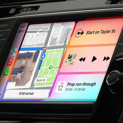
Over the weekend, there was a report that Apple did indeed acquire 3D mapping company C3 Technologies. In our original profile of the company, we mentioned that it was purchased in part from Saab AB, a Swedish aerospace and defense company.

The technology had originally been developed for military purposes such as missile targetting. Here's a video of how the mapping data is obtained:


Technology Review previously described the process:

C3's models are generated with little human intervention. First, a plane equipped with a custom-designed package of professional-grade digital single-lens reflex cameras takes aerial photos. Four cameras look out along the main compass points, at oblique angles to the ground, to image buildings from the side as well as above. Additional cameras (the exact number is secret) capture overlapping images from their own carefully determined angles, producing a final set that contains all the information needed for a full 3-D rendering of a city's buildings. Machine-vision software developed by C3 compares pairs of overlapping images to gauge depth, just as our brains use stereo vision, to produce a richly detailed 3-D model.

Top Rated Comments

flottenheimer Avatar
172 months ago
It is incredible.

I still find even the regular Google Maps to be an amazing achievement. A data-set of photos covering the entire planet at pretty close range. And we all have access. For free. That's insanely great in my book.
Score: 6 Votes (Like | Disagree)
mdriftmeyer Avatar
172 months ago
I believe that's London, not San Francisco.

Yeah, Big Ben and Wimbley kind of give it away. :D
Score: 3 Votes (Like | Disagree)
Strod Avatar
172 months ago
I know I've already posted but PLEASE!!! look at Nokia 3D mapping. I stumbled upon it by accident but the quality seems as good as the second video in this thread - and the loading time quicker.

That's cool, Chris. But I think you don't realize that Nokia/Ovi technology was actually licensed from C3 Technologies (http://www.reuters.com/article/2011/04/19/idUS246491+19-Apr-2011+BW20110419).

So... they look the same... because they ARE the same... but the point is that apparently now Apple owns the technology. :D
Score: 2 Votes (Like | Disagree)
wiz329 Avatar
172 months ago
Does anybody else realize that they are physically going to have to fly over the entire earth every time they want to update buildings, roads, etc and then generate the data? The way the video describes, it seems dreadfully slow...

the surface area of the USA alone about 10 Million km^2. Which translates to 100,000 flying hours. Which translates to 500,000 hours to interpret and graph the data. Assuming 12 hours a day (daylight hours, and this is generous due to storms etc) for flights it would take nearly 23 years of flight time (obviously they would use more than one aircraft) to create just the US. And data interpretation 24/7 for the US would take 57 years. Even if they set up 100 data interpreting stations across the US it would take over half a year to generate the data.

Then land area of the whole world is about 150 million km^2 (or 510 million if you want to also include oceans).To keep the mapping update process under a year you would need nearly 1,000 data interpreting stations and over 300 aircraft. It's all possible, but just seems like a logistical nightmare, especially for something so far outside Apple's expertise.

I'm wondering how frequently Apple would update the maps.... And if Apple didn't update the maps it would become outdated pretty quickly.


I wonder how long it took that one google street view van to drive on every single road in the world.
Score: 2 Votes (Like | Disagree)
Digitalclips Avatar
172 months ago
Does anybody else realize that they are physically going to have to fly over the entire earth every time they want to update buildings, roads, etc and then generate the data? The way the video describes, it seems dreadfully slow...

the surface area of the USA alone about 10 Million km^2. Which translates to 100,000 flying hours. Which translates to 500,000 hours to interpret and graph the data. Assuming 12 hours a day (daylight hours) for flights it would take nearly 23 years of flight time (obviously they would use more than one aircraft) to create just the US. And data interpretation 24/7 for the US would take 57 years. Even if they set up 100 data interpreting stations across the US it would take over half a year to generate the data.

Then land area of the whole world is about 150 million km^2 (or 510 million if you want to also include oceans).To keep the mapping update process under a year you would need nearly 1,000 data interpreting stations and over 300 aircraft. It's all possible, but just seems like a logistical nightmare, especially for something so far outside Apple's expertise.

I'm wondering how frequently Apple would update the maps.... And if Apple didn't update the maps it would become outdated pretty quickly.
Perhaps satellites can be used to update much of the initial imagery, heck you can read the label on a can of beans from space these days.

Which brings up another point ... When will Apple have their own satellites to augment iCloud? They can afford it ;)
Score: 2 Votes (Like | Disagree)
fifthworld Avatar
172 months ago
Does anybody else realize that they are physically going to have to fly over the entire earth every time they want to update buildings, roads, etc and then generate the data? The way the video describes, it seems dreadfully slow...

the surface area of the USA alone about 10 Million km^2. Which translates to 100,000 flying hours. Which translates to 500,000 hours to interpret and graph the data. Assuming 12 hours a day (daylight hours, and this is generous due to storms etc) for flights it would take nearly 23 years of flight time (obviously they would use more than one aircraft) to create just the US. And data interpretation 24/7 for the US would take 57 years. Even if they set up 100 data interpreting stations across the US it would take over half a year to generate the data.

Then land area of the whole world is about 150 million km^2 (or 510 million if you want to also include oceans).To keep the mapping update process under a year you would need nearly 1,000 data interpreting stations and over 300 aircraft. It's all possible, but just seems like a logistical nightmare, especially for something so far outside Apple's expertise.

I'm wondering how frequently Apple would update the maps.... And if Apple didn't update the maps it would become outdated pretty quickly.

Just to put it in perspective, mapping of our planet has been going on for more that 2,000 year.

Score: 1 Votes (Like | Disagree)

Popular Stories

New Things Your iPhone Can Do in iOS 18

20 New Things Your iPhone Can Do in iOS 18.2

Monday December 16, 2024 8:55 am PST by
Apple released iOS 18.2 in the second week of December, bringing the second round of Apple Intelligence features to iPhone 15 Pro and iPhone 16 models. This update brings several major advancements to Apple's AI integration, including completely new image generation tools and a range of Visual Intelligence-based enhancements. Apple has added a handful of new non-AI related feature controls as...
iphone 16 apple intelligence

Apple Drops Plans for iPhone Hardware Subscription Service

Wednesday December 18, 2024 11:39 am PST by
Apple is no longer planning to launch a hardware subscription service that would let customers "subscribe" to get a new iPhone each year, reports Bloomberg's Mark Gurman. Gurman first shared rumors about Apple's work on a hardware subscription service back in 2022, and at the time, he said that Apple wanted to develop a simple system that would allow customers to pay a monthly fee to gain...
blackmagic vision pro

Blackmagic Debuts $30K 3D Camera for Capturing Video for Vision Pro

Monday December 16, 2024 4:17 pm PST by
Blackmagic today announced that its URSA Cine Immersive camera is now available for pre-order, with deliveries set to start late in the first quarter of 2025. Blackmagic says that this is the world's first commercial camera system designed to capture 3D content for the Vision Pro. The URSA Cine Immersive camera was first introduced in June, but it has not been available for purchase until...
mac pro creativity

Apple Launched the Controversial 'Trashcan' Mac Pro 11 Years Ago Today

Thursday December 19, 2024 7:00 pm PST by
Apple launched the controversial "trashcan" Mac Pro eleven years ago today, introducing one of its most criticized designs that persisted through a period of widespread discontentment with the Mac lineup. The redesign took the Mac Pro in an entirely new direction, spearheaded by a polished aluminum cylindrical design that became unofficially dubbed the "trashcan" in the Mac community. All of ...
iPhone 17 Slim Feature Single Camera 2 Redux

Top 5 Apple Products to Look Forward to in 2025

Friday December 20, 2024 2:22 pm PST by
It's looking like 2025 is going to be an important year for Apple, with the company planning to revamp the iPhone, push further into smart home products, and improve Apple Intelligence. There are tons of new products rumored for 2025, including new iPhones, M4 Macs, a smart home command center, and much more. We've highlighted the top five Apple products that will have the biggest impact in...
apple tv 4k yellow bg feature

New Apple TV Rumored to Launch Next Year With These Features

Tuesday December 17, 2024 9:02 am PST by
The current Apple TV 4K was released more than two years ago, so the streaming device is becoming due for a hardware upgrade soon. Fortunately, it was recently rumored that a new Apple TV will launch at some point next year. Below, we recap rumors about the next-generation Apple TV. Bloomberg's Mark Gurman last week reported that Apple has been working on its own combined Wi-Fi and...
iPhone 17 Pro Dual Tone Feature 1

iPhone 17 Pro Rumored to Stick With 'Triangular' Camera Design

Wednesday December 18, 2024 2:36 am PST by
Contrary to recent reports, the iPhone 17 Pro will not feature a horizontal camera layout, according to the leaker known as "Instant Digital." In a new post on Weibo, the leaker said that a source has confirmed that while the appearance of the back of the iPhone 17 Pro has indeed changed, the layout of the three cameras is "still triangular," rather than the "horizontal bar spread on the...
elevation lab airtag battery

Your AirTag's Battery Will Last for Up to 10 Years With Elevation Lab's New TimeCapsule Enclosure

Wednesday December 18, 2024 10:05 am PST by
Elevation Lab today announced the launch of TimeCapsule, an innovative and simple solution for increasing the battery life of Apple's AirTag. Priced at $20, TimeCapsule is an AirTag enclosure that houses two AA batteries that offer 14x more battery capacity than the CR2032 battery that the AirTag runs on. It works by attaching the AirTag's upper housing to the built-in custom contact in the...