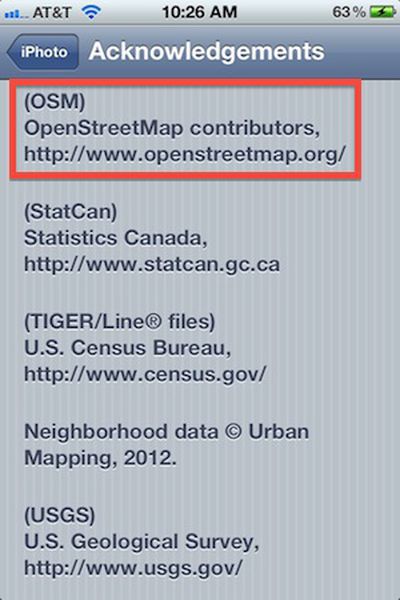
With the release of iPhoto for iOS alongside the third-generation iPad back in March, Apple began using mapping data from OpenStreetMap and others rather than Google as it has for its other map-related products thus far. Apple did, however, come under some criticism for failing to acknowledge its use of OpenStreetMap data as required by the foundation overseeing the project.
In a Tweet yesterday, OpenStreetMap noted that Apple has now included attributed in iPhoto, a change that came with the iPhoto 1.0.1 update issued on Tuesday. The attribution is included in an extensive new "Acknowledgements" page for iPhoto accessible through the Settings app.

The new acknowledgements section references a significant number of sources for mapping data, including Canada's Department of Natural Resources, Flickr Shapefiles, GeoNames, Getchee, Increment P, LeadDog, Australia's Office of Spatial Data Management, OpenStreetMap, Statistics Canada, the U.S. Census Bureau, Urban Mapping, the U.S. Geological Survey, and the National Geospatial-Intelligence Agency.
In a statement to TPM, OpenStreetMap's Richard Fairhurst noted that it seems to have taken the efforts of an iOS developer who was also an OpenStreetMap contributor to get Apple to take action on the attribution issue.
“The OSM Foundation has made informal contact with staff at Apple and, in addition, one of our volunteer mappers who is an iOS developer spoke to people at Apple. We believe it was the latter that precipitated adding the attribution - it’s great to have such an active and engaged community!
Given the large number of entities included in the new acknowledgements section, it seems likely that the delay of nearly two months in adding attribution was related to the logistics of making sure each group was credited appropriately without having to push multiple app updates to users.


